- Manuals
- Brands
- Garmin Manuals
- GPS
- GPSMAP 62
- Owner’s manual
-
Contents
-
Table of Contents
-
Troubleshooting
-
Bookmarks
Quick Links
GPSMAP
62 series
®
owner’s manual
For use with the GPSMAP 62,
62s and, 62st
Related Manuals for Garmin 62 Series
Summary of Contents for Garmin 62 Series
-
Page 1
GPSMAP 62 series ® owner’s manual For use with the GPSMAP 62, 62s and, 62st… -
Page 2
Visit the Garmin Web site (www.garmin.com) for current updates and supplemental information concerning the use and operation of this and other Garmin products. -
Page 3: Table Of Contents
Table of Contents Restoring Default Page Settings ……..11 Getting Started ….Map………..11 Compass ……… Manual Conventions ….Using the Compass ….Device Overview……Using Sight ‘N Go ….Battery Information ….Elevation Plot……Installing the Batteries ….Opening the Main Menu ..Turning the Device On or Off ..
-
Page 4
Attaching the Carabiner Clip..Altimeter Settings ….Caring for the Device ….Geocache Settings ….Troubleshooting ……. Routing Settings …… Index ……..Fitness ……..Profiles……..Appendix ……Registering Your Device ..Updating the Software ….. Viewing Important Device Information ……Contacting Garmin Product… -
Page 5: Getting Started
1. Install the batteries (page 2. Turn on the device (page 3. Acquire satellites (page 4. Mark a waypoint (page 5. Navigate a route (page 6. Record a track (page 7. Calibrate the compass (page 13). GPSMAP 62 Series Owner’s Manual…
-
Page 6: Device Overview
(under ™ batteries). Available only on the GPSMAP 62s and the GPSMAP 62st. Battery compartment Battery Information The device operates on two AA batteries. Use alkaline, NiMH, or lithium batteries. Use precharged GPSMAP 62 Series Owner’s Manual…
-
Page 7: Installing The Batteries
For best results, after you install new device determines your location. batteries, update the battery type in the 4. Quickly press to open the system settings (page 37). backlight status page. The GPS bars indicate satellite GPSMAP 62 Series Owner’s Manual…
-
Page 8: Buttons
Press OUT to zoom out on the map. QUIT Press QUIT to cancel or return to the previous menu or page. ENTER Press ENTER to select options and acknowledge messages. GPSMAP 62 Series Owner’s Manual…
-
Page 9: Editing A Waypoint
2. Select a waypoint. coordinates that you have saved. 3. Press MENu. 1. From any page, press FIND. 4. Select Delete. 2. Select Waypoints. 3. Select a waypoint. 4. Select Go. GPSMAP 62 Series Owner’s Manual…
-
Page 10: Routes
A route must contain at least two points. • Review—shows the point on the map. 7. Press quIT to save the route. • Move Down (or up)—changes the order of the point on the route. GPSMAP 62 Series Owner’s Manual…
-
Page 11: Viewing The Active Route
2. Select a route. 2. Select a route. 3. Select Reverse Route. 3. Select Delete Route. 4. Select the route again. Navigating a Route 5. Select View Map > Go. 1. Press FIND. 2. Select Routes. GPSMAP 62 Series Owner’s Manual…
-
Page 12: Additional Maps
1. Press FIND. 2. Select Addresses. 3. Enter the country. 4. Enter the city or postal code. NOTE: Not all map data provides postal code searching. 5. Select the city. GPSMAP 62 Series Owner’s Manual…
-
Page 13: Tracks
• Distance—records tracks at a specified distance. About Tracks • Time–records tracks at a Your Garmin device records a track log specified time. while you are moving. You can save these tracks and navigate to them later. • Auto—records tracks at a…
-
Page 14: Viewing The Current Track
2. Select what you want to save: 3. Select a saved track. • Save Track—saves the entire active track. 4. Select Go. • Save Portion—allows you to select a portion of the current track to save. GPSMAP 62 Series Owner’s Manual…
-
Page 15: Using The Main Pages
4. Follow the on-screen instructions. • Select Automotive Mode to show a perspective view. Restoring Default Page Settings 1. From a main page, press MENu. 2. Select Restore Defaults. 3. Press ENTER. GPSMAP 62 Series Owner’s Manual…
-
Page 16: Measuring Distance
NOTE: Higher detail settings may cause the map to redraw • Map Orientation—allows you to slowly. select how the map is displayed • Shaded Relief—shows detail relief (page 11). on the map (if available) or turns off shading. GPSMAP 62 Series Owner’s Manual…
-
Page 17: Compass
1. From the compass, press MENu. 2. Select Calibrate Compass > Start. 3. Follow the on-screen instructions. GPSMAP 62 Series Owner’s Manual…
-
Page 18: Using The Compass
1. From the main menu, select Sight ◦ True—sets true north as the ‘N Go. heading reference. 2. Point the device at an object. ◦ Magnetic—automatically sets 3. Select Lock Direction > Set the magnetic declination for Course. your location. GPSMAP 62 Series Owner’s Manual…
-
Page 19: Elevation Plot
3. Follow the on-screen instructions. a GPS compass when you are traveling at a higher rate of speed for a set period of time, or turns the compass off. • Calibrate Compass—starts the compass calibration (page 13). GPSMAP 62 Series Owner’s Manual…
-
Page 20: Opening The Main Menu
See page 18 main menu settings pages. • Adjust Zoom Ranges—adjusts the zoom ranges shown on the From any page, press MENu elevation plot page. twice. GPSMAP 62 Series Owner’s Manual…
-
Page 21: Trip Computer
From the trip computer, press MENu. • Reset—resets all the trip computer values to zero. For accurate information, reset the trip information before beginning a trip. • Big Numbers—changes the size of the numbers shown on the trip computer page. GPSMAP 62 Series Owner’s Manual…
-
Page 22: Main Menu Features And Settings
(page 39). device. You must be within 10 feet 3. Go to www.garmin.com/products (3 m) of the compatible Garmin device. /communicator. Sending and Receiving Data 4. Download the Garmin 1. From the main menu, select Share Communicator plug-in. Wirelessly.
-
Page 23: Proximity Alarms
For more information about customizing your profile, see page GPSMAP 62 Series Owner’s Manual…
-
Page 24: Satellite
• Sun and Moon—displays sunrise and sunset times along with the • Single Color—allows you to moon phase. select whether the satellite page is displayed in multicolor or single color. GPSMAP 62 Series Owner’s Manual…
-
Page 25
• Stopwatch—allows you to use a timer, mark a lap, and time laps. • Waypoint Averaging—allows you to refine a waypoint location with multiple samples to achieve the most-accurate location possible. GPSMAP 62 Series Owner’s Manual… -
Page 26: Customizing Your Device
Accuracy of GPS The margin of error for accessory per minute. required) your exact location. For example, your Course The direction from your GPS location is starting location to a accurate to within destination. +/- 12 feet. GPSMAP 62 Series Owner’s Manual…
-
Page 27
**Heart Rate Your heart rate in beats (heart rate monitor per minute (bpm). **Elevation The highest elevation required) — Maximum reached. **Elevation The lowest elevation — Minimum reached. GPSMAP 62 Series Owner’s Manual… -
Page 28
The current rate of acquire data (page 26). speed at which you Time of Day The current time of are moving since last day based on your reset. time settings (format, time zone, and daylight saving time). GPSMAP 62 Series Owner’s Manual… -
Page 29
Waypoint at Dest. The last point on reset. a route to your Trip Time — Total A running tally of destination. distance traveled since Waypoint at Next The next point on your the last reset. route. GPSMAP 62 Series Owner’s Manual… -
Page 30: System Settings
Global Positioning System user-entered data or map data, such information from a device as street names. supplying RTCM data in an • Battery Type—allows you to select SC-104 format. the type of battery you are using. GPSMAP 62 Series Owner’s Manual…
-
Page 31: Display Settings
◦ Fishing (requires marine maps)—displays a detailed Setting Up Tones view of bottom contours and Your Garmin device allows you to depth soundings. Simplifies map customize the key tones and message presentation for optimal use beeps, or to turn off tones.
-
Page 32: Setting Up Marine Alarms
1. From the main menu, select Setup > Marine Settings. 2. Select Off Course Alarm > On. 3. Enter a distance. 4. Select Done. GPSMAP 62 Series Owner’s Manual…
-
Page 33: Resetting Data
2. Select a page. Resetting Data 3. Select Move. You can reset trip data, delete all waypoints, clear the current track, or 4. Move the page up or down the list. restore default values. 5. Press ENTER. GPSMAP 62 Series Owner’s Manual…
-
Page 34: Customizing The Unit Settings
1. From the main menu, select Setup chart that specifies a different position > units. format. 2. Select a setting. From the main menu, select Setup > 3. Select a unit for the setting. Position Format. GPSMAP 62 Series Owner’s Manual…
-
Page 35: Altimeter Settings
◦ Elevation/Distance—records • Barometer Mode elevation changes over a distance. ◦ Variable Elevation—the barometer functions while you ◦ Barometric Pressure—records are moving. barometric pressure over a period of time. GPSMAP 62 Series Owner’s Manual…
-
Page 36: Geocache Settings
◦ Manual—allows you to select calculating your route. the next point on the route by ◦ Off Road—calculates point-to- using the point on the active point routes. route page. GPSMAP 62 Series Owner’s Manual…
-
Page 37: Fitness
Deleting a Profile 1. From the main menu, select Setup You can select Recreational, or save a > Profiles. custom profile for your device. 2. Select a profile. To change profiles, see page 3. Select Delete. GPSMAP 62 Series Owner’s Manual…
-
Page 38: Appendix
USA by phone at (913) 397.8200 or 1. Go to www.garmin.com (800) 800.1020. /webupdater. • In the UK, contact Garmin (Europe) 2. Follow the on-screen instructions. Ltd. by phone at 0808 2380000. NOTE: This does not erase any of your data or settings.
-
Page 39: Using The Backlight
2.6 × 6.0 × 1.2 in. the GPSMAP 62st: (W × H × D) (6.6 × 15.2 × 3.0 cm) • No memory battery is required. Weight 7.8 oz. (222.3 g) with batteries Computer interface GPSMAP 62 Series Owner’s Manual…
-
Page 40: Maximizing Battery Life
Availability (SA) Using the Battery Save Option Program when Use the battery save option to save activated. battery power and prolong battery life. From the main menu, select Setup > Display > Battery Save > On. GPSMAP 62 Series Owner’s Manual…
-
Page 41: Decreasing The Backlight
Stored data is not lost when WARNING batteries are removed. See the Important Safety and Product Information guide in the product box for product warnings and other important information. GPSMAP 62 Series Owner’s Manual…
-
Page 42: Buying Optional Accessories
You can use optional fitness accessories including a heart rate monitor or a cadence sensor with your device. GPSMAP 62 Series Owner’s Manual…
-
Page 43: Data Management
• GPI custom POI files from the each time it is activated. This Garmin POI Loader. process occurs automatically when you turn on the Garmin device and Installing a microSD Card only takes a few seconds when NOTE: The microSD card option is…
-
Page 44
Appendix purchase preloaded detailed map data cards from your Garmin dealer. In addition to map and data storage, the memory cards can be used to store files such as images, cartridges, geocaches, microSD card routes, waypoints, and custom POIs. slot 1. -
Page 45: Connecting The Usb Cable
2. Select the file. charging or connecting to a computer. 3. Select Edit > Copy. 1. Connect the USB cable to a USB 4. Open the “Garmin” or memory card port on your computer. drive/volume. 2. Pull up the weather cap from the 5.
-
Page 46: Deleting Files
2. Disconnect the device from your (page 39). computer. 1. Open the “Garmin” drive or Attaching the Wrist Strap volume. 2. If necessary, open a folder or 1. Place the loop of the wrist strap volume.
-
Page 47: Attaching The Carabiner Clip
Lift the bottom of the clip and 3. Apply the liquid to the cloth, and gently push down on the carabiner gently wipe the screen with the clip until it releases. cloth. GPSMAP 62 Series Owner’s Manual…
-
Page 48: Troubleshooting
(page 37). long. How do I know my On the device, a screen appears showing the Garmin logo and device is in USB mass the USB symbol. On your computer, you should see a new storage mode? removable disk drive in My Computer on Windows computers and a mounted volume on Mac computers.
-
Page 49
Windows may have trouble assigning drive letters to your list of drives. Garmin drives. See the Help file for your operating system to learn how to assign drive letters. I need replacement parts Go to http://buy.garmin.com, or contact your Garmin dealer. -
Page 50: Index
ANT+ accessories long-term storage profiles area calculation compass routes AutoLocate calibrating tracks navigating waypoints setup options display backlight 35, 37 connecting backlight BaseCamp USB cable backlight timeout batteries 22, 26, 36 GPSMAP 62 Series Owner’s Manual…
-
Page 51
4, 5, 7, 8, 10 tracks changing orientation fitness options datum detail PAGE button Garmin Product information pages Support measuring distance adding a page geocaches 18, 32 setup options removing downloading showing tracks sequence navigating viewing routes position format GPSMAP 62 Series Owner’s Manual… -
Page 52
USB Rocker sun and moon times wirelessly routes system settings trip computer active route troubleshooting avoidance GPSMAP 62 Series Owner’s Manual… -
Page 53
Index unit ID updating software USB cable connecting disconnecting waypoints averaging creating deleting editing navigating to wrist strap zooming 4, 12 zoom ranges GPSMAP 62 Series Owner’s Manual… -
Page 56
For the latest free software updates (excluding map data) throughout the life of your Garmin products, visit the Garmin Web site at www.garmin.com. © 2010 Garmin Ltd. or its subsidiaries Garmin International, Inc. 1200 East 151 Street, Olathe, Kansas 66062, USA Garmin (Europe) Ltd.
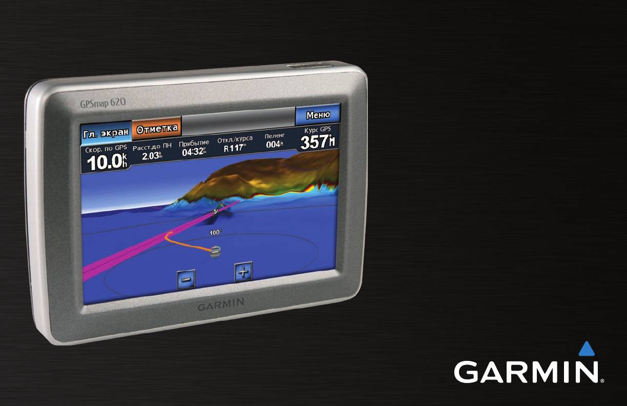
Gpsmap, Серии 62, Краткое руководство по эксплуатации
- Текст
- Оригинал
Advertising

GPSMAP
®
серии 62
Краткое руководство по
эксплуатации
Для моделей GPSMAP 62,
62s и 62st
Advertising
Эта инструкция подходит к следующим моделям:
GPSMAP 62s, GPSMAP 62st
®
GPSMAP
620
Руководство
пользователя
© 2008 Garmin Ltd. или подразделения
Garmin International, Inc.
Garmin Ltd. (Европа)
Корпорация Garmin
1200 East 151st Street,
Liberty House
№ 68, Jangshu 2nd Road,
Olathe, Kansas 66062, USA
Hounsdown Business Park,
Shijr, Taipei County, Taiwan
Тел.: (913) 397-8200 или (800) 800-1020
Southampton, Hampshire, SO40 9RB UK
Тел.: (886) 2-2642-9199
Факс: (913) 397-8282
Тел.: +44 (0) 870-8501241 (звонок не из Великобритании)
Факс: (886) 2-2642-9099
0808 2380000 (звонок из Великобритании)
Факс: +44 (0) 870-8501251
Все права сохранены. За исключением случаев, когда иное явно указано в настоящем документе, никакая часть данного руководства не может быть воспроизведена, скопирована,
передана, распространена, загружена или сохранена на каком-либо носителе в любых целях без предварительного письменного разрешения компании Garmin. Компания Garmin
предоставляет разрешение на загрузку одной копии данного руководства на жесткий диск или другой электронный носитель информации для просмотра и печати одной копии
данного руководства или внесенных в него изменений при условии, что такая электронная или печатная копия содержит полный текст этого предупреждения об авторских правах.
Любое несанкционированное коммерческое распространение или изменение данного руководства строго запрещены.
Приведенная в этом документе информация может быть изменена без уведомления. Компания Garmin оставляет за собой право изменять или улучшать продукты и
вносить изменения в содержание без обязательства уведомлять какое-либо лицо или организацию о таких изменениях или улучшениях. Посетите веб-сайт компании
Garmin (www.garmin.com) для получения последних обновлений и дополнительной информации об использовании этого и других продуктов Garmin.
Garmin
®
, логотип Garmin, GPSMAP
®
, BlueChart
®
, g2 Vision
®
и MapSource
®
являются товарными знаками компании Garmin Ltd. или ее подразделений, зарегистрированными в
США и других странах. Данные товарные знаки запрещено использовать без явного разрешения Garmin.
Windows
®
и Windows NT
®
являются товарными знаками компании Microsoft Corporation, зарегистрированными в США и других странах. Mac
®
является зарегистрированным
товарным знаком компании Apple Computer, Inc.
Декабрь, 2008 Номер документа 190-01006-45 Вер. A Отпечатано на Тайване

Введение
®
Введение
Связаться с Garmin
®
В случае возникновения вопросов при использовании устройства
GPSMAP
620 представляет собой судовую и автомобильную
GPSMAP 620 обратитесь в службу поддержки компании Garmin.
навигационную систему на основе GPS. Автомобильный комплект,
В США посетите сайт www.garmin.com/support, либо позвоните
в состав которого входят карты дорог и кронштейн для автомобиля,
в компанию Garmin USA по телефону (913) 397-8200 или
продается отдельно. При помещении устройства в кронштейн,
(800) 800-1020.
установленный на корабле, он автоматически переключается
в судовой режим. При помещении устройства в кронштейн,
В Великобритании свяжитесь с Garmin (Europe) Ltd. по телефону
установленный в автомобиле, он автоматически переключается
0808 2380000.
в автомобильный режим.
В Европе посетите сайт www.garmin.com/support и щелкните
Настоящее руководство поделено на два раздела; первый раздел
, чтобы получить сведения о предоставлении поддержки в
описывает использование GPSMAP 620 в судовом режиме, а второй
вашей стране, либо позвоните в копанию Garmin (Europe) Ltd. по
— в автомобильном. Данные разделы помечены при помощи язычков
телефону +44 (0) 870.8501241.
по краю страницы, что поможет определить, о каком режиме идет
речь.
Используемые обозначения
В тексте данного руководства указание “коснуться” чего-либо
См. руководство Важные сведения о продукте и информация о безопасности
означает, что необходимо коснуться пальцем этого элемента на
в упаковке изделия для ознакомления с предупреждениями по безопасности и
экране. Небольшие стрелочки (>) в тексте указывают, что необходимо
другой важной информацией.
последовательно коснуться нескольких указанных элементов.
Например, если вы видите такой текст — “Коснитесь >
Регистрация продукта
”, то необходимо коснуться экранной кнопки
Зарегистрируйте продукт сегодня, чтобы мы могли лучше
, а затем коснуться кнопки .
обслуживать вас. Посетите веб-сайт http://my.garmin.com.
Храните чек или его копию в надежном месте.
Руководство пользователя GPSMAP 620

Содержание
Судовой режим: Работа с картами ……………………………8
Содержание
Навигационная карта ……………………………………………………….. 8
Введение ……………………………………………………………………i
Взаимодействие с объектами на навигационной карте ………. 8
Регистрация продукта ……………………………………………………….. i
Доступ к дополнительным объектам или
®
Связаться с Garmin
…………………………………………………………. i
информации о карте ………………………………………………………. 9
Используемые обозначения ………………………………………………. i
Mariner’s Eye ………………………………………………………………….. 10
BlueChart g2 Vision …………………………………………………………. 10
Начало работы ………………………………………………………….1
Mariner’s Eye 3D ………………………………………………………………11
Основные элементы GPSMAP 620 ……………………………………. 1
Fish Eye 3D ……………………………………………………………………..11
Элементы крепежной скобы GPSMAP 620 ………………………… 1
Карта рыбалки …………………………………………………………………11
Использование крепежной скобы ……………………………………… 2
Активация спутниковых изображений
Включение/выключение питания устройства GPSMAP 620 … 3
высокого разрешения …………………………………………………… 12
Извлечение и установка аккумулятора ……………………………… 3
Установка и извлечение карты памяти Secure Digital (SD) ….. 4
Судовой режим: Навигация …………………………………….13
Шаг 1: Выбор пункта назначения …………………………………….. 13
Судовой режим: Начало работы ……………………………….5
Шаг 2: Построение и следование курсу ……………………………. 13
Шаг 1: Закрепление GPSMAP 620 …………………………………….. 5
Шаг 2: Настройка GPSMAP 620 ………………………………………… 5
Судовой режим: Куда? …………………………………………….19
Шаг 3: Установка связи со спутниками ………………………………. 5
Поиск морских служб ……………………………………………………… 19
Шаг 4: Работа с GPSMAP 620 …………………………………………… 5
Поиск маршрутных точек ………………………………………………… 19
Навигация непосредственно к месту назначения ………………. 6
Поиск сохраненных маршрутов ………………………………………. 19
Сохранение текущей позиции …………………………………………… 6
Поиск сохраненных треков ……………………………………………… 20
Навигация непосредственно к сохраненной позиции …………. 7
Поиск по имени ………………………………………………………………. 20
Остановка навигации ……………………………………………………….. 7
Судовой режим: Маршрутные точки и треки …………..21
Регулировка громкости …………………………………………………….. 7
Маршрутные точки Человек за бортом (MOB) ………………….. 21
Настройка подсветки………………………………………………………… 7
Отметка текущей позиции как маршрутной точки …………….. 21
Руководство пользователя GPSMAP 620

Содержание
Создание маршрутной точки на навигационной карте ………. 21
Изменение единиц измерения ………………………………………… 33
Изменение деталей маршрутной точки ……………………………. 22
Настройка параметров коммуникации …………………………….. 34
Треки …………………………………………………………………………….. 22
Настройка параметров сигналов …………………………………….. 34
Настройка параметров раздела Моя Лодка ……………………… 35
Судовой режим: Панель управления ………………………24
Настройка других судов ………………………………………………….. 36
Экран “Компас” ………………………………………………………………. 24
Настройка параметров навигационной карты ………………….. 36
Экран “Числа” ………………………………………………………………… 25
Настройка параметров Мariner’s Eye и параметров
Экран “Поездка” ……………………………………………………………… 25
Mariner’s Eye 3D …………………………………………………………… 39
Судовой режим: просмотр данных календаря………..26
Параметры Fish Eye 3D ………………………………………………….. 40
Просмотр информации станций
Настройка карты рыбалки ………………………………………………. 40
наблюдения за приливами ……………………………………………. 26
Установка параметров активного трека …………………………… 41
Просмотр информации о течениях ………………………………….. 26
Настройка экрана Числа …………………………………………………. 41
Просмотр астрономических данных ………………………………… 27
Автомобильный режим: Начало работы…………………42
Судовой режим: управление данными
Шаг 1: Закрепление GPSMAP 620 …………………………………… 42
пользователями ………………………………………………………28
Шаг 2: Настройка GPSMAP 620 ………………………………………. 42
Передача данных (маршрутных точек, маршрутов, треков)
Шаг 3: Установка связи со спутниками …………………………….. 42
на карту или с карты памяти SD ……………………………………. 28
Шаг 4: Работа с GPSMAP 620 …………………………………………. 42
Резервное копирование данных на компьютер ………………… 28
Поиск пункта назначения ………………………………………………… 43
®
Копирование или объединение данных MapSource
на
Добавление остановки ……………………………………………………. 43
GPSMAP 620 ……………………………………………………………….. 29
Дорога в объезд ……………………………………………………………… 43
Судовой режим: Управление информацией
Остановка навигации по маршруту …………………………………. 43
от других судов ……………………………………………………….30
Автомобильный режим: Куда? ……………………………….44
Просмотр информации AIS …………………………………………….. 30
Поиск адреса …………………………………………………………………. 44
Просмотр информации DSC …………………………………………… 30
Задание позиции “Дом” …………………………………………………… 44
Параметры страницы Старт! ………………………………………….. 45
Судовой режим: расширенные настройки ………………32
Поиск объекта по буквам имени …………………………………….. 45
Настройка параметров системы ……………………………………… 32
Руководство пользователя GPSMAP 620

Содержание
Поиск рядом с другим местом …………………………………………. 45
Настройка подсветки………………………………………………………. 54
Поиск недавно найденных объектов ……………………………….. 45
Обновление параметров времени …………………………………… 54
Избранное. …………………………………………………………………….. 46
Настройка языковых параметров ……………………………………. 54
Поиск объекта с помощью карты …………………………………….. 46
Изменение параметров карты …………………………………………. 54
Маршруты ……………………………………………………………………… 47
Изменение параметров безопасности ……………………………… 55
Ввод координат ……………………………………………………………… 48
Восстановление всех заводских установок ………………………. 55
Навигация вне дорог ………………………………………………………. 48
Приложение …………………………………………………………….56
Автомобильный режим: работа с картой ………………..49
Калибровка экрана …………………………………………………………. 56
Следующий поворот ………………………………………………………. 49
Сброс параметров GPSMAP 620 …………………………………….. 56
Список поворотов …………………………………………………………… 49
Обновление программного обеспечения …………………………. 56
Счетчик движения ………………………………………………………….. 50
Удаление пользовательских данных ……………………………….. 56
Данные о состоянии элемента питания ………………………….. 56
Автомобильный режим: управление файлами ………51
Зарядка GPSMAP 620 …………………………………………………….. 57
Загрузка файлов ……………………………………………………………. 51
Замена предохранителя на автомобильной скобе ……………. 57
Удаление файлов ………………………………………………………….. 51
Уход за GPSMAP 620 …………………………………………………….. 57
Автомобильный режим: Инструменты ……………………52
Дополнительные карты …………………………………………………… 58
Настройки ……………………………………………………………………… 52
О спутниковых сигналах GPS …………………………………………. 58
Где я? ……………………………………………………………………………. 52
Дополнительные средства и аксессуары …………………………. 59
Просмотр фотоснимков ………………………………………………….. 52
Технические характеристики …………………………………………… 59
Данные пользователя …………………………………………………….. 52
Заявление о соответствии ………………………………………………. 60
Автомобильный режим: расширенные настройки …53
Лицензионное соглашение на программное обеспечение … 60
Изменение системных параметров …………………………………. 53
Устранение неполадок ……………………………………………………. 60
Изменение параметров навигации ………………………………….. 53
Сообщения и аварийные сигналы (судовой режим) …………. 61
Регулировка параметров дисплея …………………………………… 53
Указатель ………………………………………………………………..62
Регулировка громкости …………………………………………………… 54
v Руководство пользователя GPSMAP 620
На этой странице вы можете совершенно бесплатно скачать Инструкция по эксплуатации Garmin MAP 62stc.
У документа PDF Инструкция по эксплуатации 12 страниц, а его размер составляет 583 Kb.
Читать онлайн GPS-навигаторы Garmin MAP 62stc Инструкция по эксплуатации

Скачать файл PDF «Garmin MAP 62stc Инструкция по эксплуатации» (583 Kb)
Популярность:
769 просмотры
Подсчет страниц:
12 страницы
Тип файла:
Размер файла:
583 Kb
Прочие инструкции Garmin MAP 62stc


Прочие инструкции Garmin GPS-навигаторы


Прочие инструкции Garmin


-
Page 1
GPSMAP 62 series ® owner’s manual For use with the GPSMAP 62, 62s and, 62st… -
Page 2
Visit the Garmin Web site (www.garmin.com) for current updates and supplemental information concerning the use and operation of this and other Garmin products. -
Page 3: Table Of Contents
Table of Contents Restoring Default Page Settings ……..11 Getting Started ….Map………..11 Compass ……… Manual Conventions ….Using the Compass ….Device Overview……Using Sight ‘N Go ….Battery Information ….Elevation Plot……Installing the Batteries ….Opening the Main Menu ..Turning the Device On or Off ..
-
Page 4
Attaching the Carabiner Clip..Altimeter Settings ….Caring for the Device ….Geocache Settings ….Troubleshooting ……. Routing Settings …… Index ……..Fitness ……..Profiles……..Appendix ……Registering Your Device ..Updating the Software ….. Viewing Important Device Information ……Contacting Garmin Product… -
Page 5: Getting Started
1. Install the batteries (page 2. Turn on the device (page 3. Acquire satellites (page 4. Mark a waypoint (page 5. Navigate a route (page 6. Record a track (page 7. Calibrate the compass (page 13). GPSMAP 62 Series Owner’s Manual…
-
Page 6: Device Overview
(under ™ batteries). Available only on the GPSMAP 62s and the GPSMAP 62st. Battery compartment Battery Information The device operates on two AA batteries. Use alkaline, NiMH, or lithium batteries. Use precharged GPSMAP 62 Series Owner’s Manual…
-
Page 7: Installing The Batteries
For best results, after you install new device determines your location. batteries, update the battery type in the 4. Quickly press to open the system settings (page 37). backlight status page. The GPS bars indicate satellite GPSMAP 62 Series Owner’s Manual…
-
Page 8: Buttons
Press OUT to zoom out on the map. QUIT Press QUIT to cancel or return to the previous menu or page. ENTER Press ENTER to select options and acknowledge messages. GPSMAP 62 Series Owner’s Manual…
-
Page 9: Editing A Waypoint
2. Select a waypoint. coordinates that you have saved. 3. Press MENu. 1. From any page, press FIND. 4. Select Delete. 2. Select Waypoints. 3. Select a waypoint. 4. Select Go. GPSMAP 62 Series Owner’s Manual…
-
Page 10: Routes
A route must contain at least two points. • Review—shows the point on the map. 7. Press quIT to save the route. • Move Down (or up)—changes the order of the point on the route. GPSMAP 62 Series Owner’s Manual…
-
Page 11: Viewing The Active Route
2. Select a route. 2. Select a route. 3. Select Reverse Route. 3. Select Delete Route. 4. Select the route again. Navigating a Route 5. Select View Map > Go. 1. Press FIND. 2. Select Routes. GPSMAP 62 Series Owner’s Manual…
-
Page 12: Additional Maps
1. Press FIND. 2. Select Addresses. 3. Enter the country. 4. Enter the city or postal code. NOTE: Not all map data provides postal code searching. 5. Select the city. GPSMAP 62 Series Owner’s Manual…
-
Page 13: Tracks
• Distance—records tracks at a specified distance. About Tracks • Time–records tracks at a Your Garmin device records a track log specified time. while you are moving. You can save these tracks and navigate to them later. • Auto—records tracks at a…
-
Page 14: Viewing The Current Track
2. Select what you want to save: 3. Select a saved track. • Save Track—saves the entire active track. 4. Select Go. • Save Portion—allows you to select a portion of the current track to save. GPSMAP 62 Series Owner’s Manual…
-
Page 15: Using The Main Pages
4. Follow the on-screen instructions. • Select Automotive Mode to show a perspective view. Restoring Default Page Settings 1. From a main page, press MENu. 2. Select Restore Defaults. 3. Press ENTER. GPSMAP 62 Series Owner’s Manual…
-
Page 16: Measuring Distance
NOTE: Higher detail settings may cause the map to redraw • Map Orientation—allows you to slowly. select how the map is displayed • Shaded Relief—shows detail relief (page 11). on the map (if available) or turns off shading. GPSMAP 62 Series Owner’s Manual…
-
Page 17: Compass
1. From the compass, press MENu. 2. Select Calibrate Compass > Start. 3. Follow the on-screen instructions. GPSMAP 62 Series Owner’s Manual…
-
Page 18: Using The Compass
1. From the main menu, select Sight ◦ True—sets true north as the ‘N Go. heading reference. 2. Point the device at an object. ◦ Magnetic—automatically sets 3. Select Lock Direction > Set the magnetic declination for Course. your location. GPSMAP 62 Series Owner’s Manual…
-
Page 19: Elevation Plot
3. Follow the on-screen instructions. a GPS compass when you are traveling at a higher rate of speed for a set period of time, or turns the compass off. • Calibrate Compass—starts the compass calibration (page 13). GPSMAP 62 Series Owner’s Manual…
-
Page 20: Opening The Main Menu
See page 18 main menu settings pages. • Adjust Zoom Ranges—adjusts the zoom ranges shown on the From any page, press MENu elevation plot page. twice. GPSMAP 62 Series Owner’s Manual…
-
Page 21: Trip Computer
From the trip computer, press MENu. • Reset—resets all the trip computer values to zero. For accurate information, reset the trip information before beginning a trip. • Big Numbers—changes the size of the numbers shown on the trip computer page. GPSMAP 62 Series Owner’s Manual…
-
Page 22: Main Menu Features And Settings
(page 39). device. You must be within 10 feet 3. Go to www.garmin.com/products (3 m) of the compatible Garmin device. /communicator. Sending and Receiving Data 4. Download the Garmin 1. From the main menu, select Share Communicator plug-in. Wirelessly.
-
Page 23: Proximity Alarms
For more information about customizing your profile, see page GPSMAP 62 Series Owner’s Manual…
-
Page 24: Satellite
• Sun and Moon—displays sunrise and sunset times along with the • Single Color—allows you to moon phase. select whether the satellite page is displayed in multicolor or single color. GPSMAP 62 Series Owner’s Manual…
-
Page 25
• Stopwatch—allows you to use a timer, mark a lap, and time laps. • Waypoint Averaging—allows you to refine a waypoint location with multiple samples to achieve the most-accurate location possible. GPSMAP 62 Series Owner’s Manual… -
Page 26: Customizing Your Device
Accuracy of GPS The margin of error for accessory per minute. required) your exact location. For example, your Course The direction from your GPS location is starting location to a accurate to within destination. +/- 12 feet. GPSMAP 62 Series Owner’s Manual…
-
Page 27
**Heart Rate Your heart rate in beats (heart rate monitor per minute (bpm). **Elevation The highest elevation required) — Maximum reached. **Elevation The lowest elevation — Minimum reached. GPSMAP 62 Series Owner’s Manual… -
Page 28
The current rate of acquire data (page 26). speed at which you Time of Day The current time of are moving since last day based on your reset. time settings (format, time zone, and daylight saving time). GPSMAP 62 Series Owner’s Manual… -
Page 29
Waypoint at Dest. The last point on reset. a route to your Trip Time — Total A running tally of destination. distance traveled since Waypoint at Next The next point on your the last reset. route. GPSMAP 62 Series Owner’s Manual… -
Page 30: System Settings
Global Positioning System user-entered data or map data, such information from a device as street names. supplying RTCM data in an • Battery Type—allows you to select SC-104 format. the type of battery you are using. GPSMAP 62 Series Owner’s Manual…
-
Page 31: Display Settings
◦ Fishing (requires marine maps)—displays a detailed Setting Up Tones view of bottom contours and Your Garmin device allows you to depth soundings. Simplifies map customize the key tones and message presentation for optimal use beeps, or to turn off tones.
-
Page 32: Setting Up Marine Alarms
1. From the main menu, select Setup > Marine Settings. 2. Select Off Course Alarm > On. 3. Enter a distance. 4. Select Done. GPSMAP 62 Series Owner’s Manual…
-
Page 33: Resetting Data
2. Select a page. Resetting Data 3. Select Move. You can reset trip data, delete all waypoints, clear the current track, or 4. Move the page up or down the list. restore default values. 5. Press ENTER. GPSMAP 62 Series Owner’s Manual…
-
Page 34: Customizing The Unit Settings
1. From the main menu, select Setup chart that specifies a different position > units. format. 2. Select a setting. From the main menu, select Setup > 3. Select a unit for the setting. Position Format. GPSMAP 62 Series Owner’s Manual…
-
Page 35: Altimeter Settings
◦ Elevation/Distance—records • Barometer Mode elevation changes over a distance. ◦ Variable Elevation—the barometer functions while you ◦ Barometric Pressure—records are moving. barometric pressure over a period of time. GPSMAP 62 Series Owner’s Manual…
-
Page 36: Geocache Settings
◦ Manual—allows you to select calculating your route. the next point on the route by ◦ Off Road—calculates point-to- using the point on the active point routes. route page. GPSMAP 62 Series Owner’s Manual…
-
Page 37: Fitness
Deleting a Profile 1. From the main menu, select Setup You can select Recreational, or save a > Profiles. custom profile for your device. 2. Select a profile. To change profiles, see page 3. Select Delete. GPSMAP 62 Series Owner’s Manual…
-
Page 38: Appendix
USA by phone at (913) 397.8200 or 1. Go to www.garmin.com (800) 800.1020. /webupdater. • In the UK, contact Garmin (Europe) 2. Follow the on-screen instructions. Ltd. by phone at 0808 2380000. NOTE: This does not erase any of your data or settings.
-
Page 39: Using The Backlight
2.6 × 6.0 × 1.2 in. the GPSMAP 62st: (W × H × D) (6.6 × 15.2 × 3.0 cm) • No memory battery is required. Weight 7.8 oz. (222.3 g) with batteries Computer interface GPSMAP 62 Series Owner’s Manual…
-
Page 40: Maximizing Battery Life
Availability (SA) Using the Battery Save Option Program when Use the battery save option to save activated. battery power and prolong battery life. From the main menu, select Setup > Display > Battery Save > On. GPSMAP 62 Series Owner’s Manual…
-
Page 41: Decreasing The Backlight
Stored data is not lost when WARNING batteries are removed. See the Important Safety and Product Information guide in the product box for product warnings and other important information. GPSMAP 62 Series Owner’s Manual…
-
Page 42: Buying Optional Accessories
You can use optional fitness accessories including a heart rate monitor or a cadence sensor with your device. GPSMAP 62 Series Owner’s Manual…
-
Page 43: Data Management
• GPI custom POI files from the each time it is activated. This Garmin POI Loader. process occurs automatically when you turn on the Garmin device and Installing a microSD Card only takes a few seconds when NOTE: The microSD card option is…
-
Page 44
Appendix purchase preloaded detailed map data cards from your Garmin dealer. In addition to map and data storage, the memory cards can be used to store files such as images, cartridges, geocaches, microSD card routes, waypoints, and custom POIs. slot 1. -
Page 45: Connecting The Usb Cable
2. Select the file. charging or connecting to a computer. 3. Select Edit > Copy. 1. Connect the USB cable to a USB 4. Open the “Garmin” or memory card port on your computer. drive/volume. 2. Pull up the weather cap from the 5.
-
Page 46: Deleting Files
2. Disconnect the device from your (page 39). computer. 1. Open the “Garmin” drive or Attaching the Wrist Strap volume. 2. If necessary, open a folder or 1. Place the loop of the wrist strap volume.
-
Page 47: Attaching The Carabiner Clip
Lift the bottom of the clip and 3. Apply the liquid to the cloth, and gently push down on the carabiner gently wipe the screen with the clip until it releases. cloth. GPSMAP 62 Series Owner’s Manual…
-
Page 48: Troubleshooting
(page 37). long. How do I know my On the device, a screen appears showing the Garmin logo and device is in USB mass the USB symbol. On your computer, you should see a new storage mode? removable disk drive in My Computer on Windows computers and a mounted volume on Mac computers.
-
Page 49
Windows may have trouble assigning drive letters to your list of drives. Garmin drives. See the Help file for your operating system to learn how to assign drive letters. I need replacement parts Go to http://buy.garmin.com, or contact your Garmin dealer. -
Page 50: Index
ANT+ accessories long-term storage profiles area calculation compass routes AutoLocate calibrating tracks navigating waypoints setup options display backlight 35, 37 connecting backlight BaseCamp USB cable backlight timeout batteries 22, 26, 36 GPSMAP 62 Series Owner’s Manual…
-
Page 51
4, 5, 7, 8, 10 tracks changing orientation fitness options datum detail PAGE button Garmin Product information pages Support measuring distance adding a page geocaches 18, 32 setup options removing downloading showing tracks sequence navigating viewing routes position format GPSMAP 62 Series Owner’s Manual… -
Page 52
USB Rocker sun and moon times wirelessly routes system settings trip computer active route troubleshooting avoidance GPSMAP 62 Series Owner’s Manual… -
Page 53
Index unit ID updating software USB cable connecting disconnecting waypoints averaging creating deleting editing navigating to wrist strap zooming 4, 12 zoom ranges GPSMAP 62 Series Owner’s Manual… -
Page 56
For the latest free software updates (excluding map data) throughout the life of your Garmin products, visit the Garmin Web site at www.garmin.com. © 2010 Garmin Ltd. or its subsidiaries Garmin International, Inc. 1200 East 151 Street, Olathe, Kansas 66062, USA Garmin (Europe) Ltd.